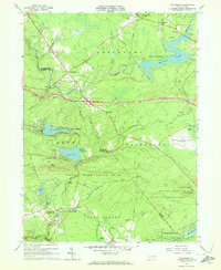
1965 Map of Blakeslee
USGS Topo · Published 1972About this map
Monroe Co and Carbon Co meet along the ridge of Lake Mountain, where the 1960s landscape shows a transition toward modern recreation and infrastructure. The mid-century development of the Pocono region is evident in the construction of the Pocono International Raceway and the presence of the Big Boulder Ski Resort near Lake Harmony. While older settlements like Albrightsville and Blakeslee anchor the road network, new vacation-oriented communities such as Locust Lakes Village and Pocono Lake Preserve suggest the area's evolving character as a seasonal retreat.
Find a feature on this map
63 named features on this map. Tap any name to fly to it.
Don’t see what you’re looking for? This feature index may not catch every label — zoom into the map to look around manually.
Map Details
Editions of this 1965 Blakeslee Map
4 editions found
Other maps of this area

1914 · Wind Gap
USGS Topo · 1:62,500

1916 · Wind Gap
USGS Topo · 1:62,500

1919 · Pocono
USGS Topo · 1:62,500

1921 · Pocono
USGS Topo · 1:62,500

1922 · Mauch Chunk
USGS Topo · 1:62,500

1922 · Stoddartsville
USGS Topo · 1:62,500

1923 · Pocono
USGS Topo · 1:62,500

1924 · Stoddartsville
USGS Topo · 1:62,500

1924 · Mauch Chunk
USGS Topo · 1:62,500

1943 · Scranton
USGS Topo · 1:125,000
Featured Places
- Kidder Township, PA
- Pocono Pines, Tobyhanna Township
- Penn Forest Township, PA
- Tobyhanna Township, PA
- Tunkhannock Township, PA