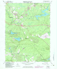
1965 Map of Blakeslee
USGS Topo · Published 1984About this map
Tobyhanna Creek and Tunkhannock Creek carve through this section of the Poconos, marking a landscape defined by its transition from traditional timber and game lands to a mid-century recreation hub. The map highlights the early development of the Pocono International Raceway on the eastern edge, while the southwestern corner near Albrightsville shows the expansion of residential lake communities like Indian Mountain Lake.
Find a feature on this map
62 named features on this map. Tap any name to fly to it.
Don’t see what you’re looking for? This feature index may not catch every label — zoom into the map to look around manually.
Map Details
Editions of this 1965 Blakeslee Map
4 editions found
Other maps of this area

1914 · Wind Gap
USGS Topo · 1:62,500

1916 · Wind Gap
USGS Topo · 1:62,500

1919 · Pocono
USGS Topo · 1:62,500

1921 · Pocono
USGS Topo · 1:62,500

1922 · Mauch Chunk
USGS Topo · 1:62,500

1922 · Stoddartsville
USGS Topo · 1:62,500

1923 · Pocono
USGS Topo · 1:62,500

1924 · Stoddartsville
USGS Topo · 1:62,500

1924 · Mauch Chunk
USGS Topo · 1:62,500

1943 · Scranton
USGS Topo · 1:125,000
Featured Places
- Kidder Township, PA
- Pocono Pines, Tobyhanna Township
- Penn Forest Township, PA
- Tobyhanna Township, PA
- Tunkhannock Township, PA