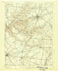
1907 Map of Blanchester
USGS Topo · Published 1931About this map
Wilmington serves as the focal point of this Clinton County landscape, where the Baltimore and Ohio Southwestern RR intersects several historic pikes, including the Sabina Pike and Columbus Pike. The map reveals a highly developed rural social structure at the turn of the century, marked by institutions such as the County Infirmary and the Childrens Home north of the city. To the south, Blanchester and Midland anchor a network of smaller agrarian settlements like Cuba and Martinsville.
Find a feature on this map
80 named features on this map. Tap any name to fly to it.
Don’t see what you’re looking for? This feature index may not catch every label — zoom into the map to look around manually.
Map Details
Editions of this 1907 Blanchester Map
3 editions found
Other maps of this area

1907 · Blanchester
USGS Topo · 1:62,500

1913 · Waynesville
USGS Topo · 1:62,500

1914 · Batavia
USGS Topo · 1:48,000

1914 · Morrow
USGS Topo · 1:62,500

1915 · Waynesville
USGS Topo · 1:62,500

1916 · Batavia
USGS Topo · 1:62,500

1916 · Morrow
USGS Topo · 1:62,500

1916 · Octa
USGS Topo · 1:62,500

1917 · Xenia
USGS Topo · 1:62,500

1917 · Hillsboro
USGS Topo · 1:62,500