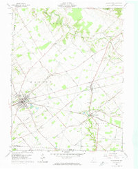
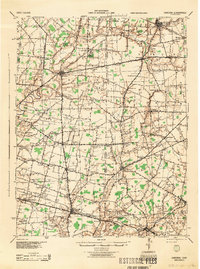
1961 Map of Blanchester
USGS Topo · Published 1974About this map
The Baltimore and Ohio Railroad forms the backbone of commerce in this part of southwestern Ohio, connecting the settlements of Blanchester, Midland, and Westboro. Situated within the Virginia Military District, the landscape is defined by the winding waters of Todd Fork and East Fork, which drain a region of productive farmland interlaced with family-named roads like Pansy Road and Rhude Road. At the eastern edge, an Indian Mound stands as a ancient landmark near the crossing of Gumley Road.
Find a feature on this map
67 named features on this map. Tap any name to fly to it.
Don’t see what you’re looking for? This feature index may not catch every label — zoom into the map to look around manually.
Map Details
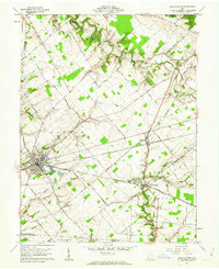
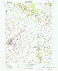
Editions of this 1961 Blanchester Map
4 editions found

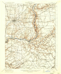
Other maps of this area

1907 · Blanchester
USGS Topo · 1:62,500

1914 · Batavia
USGS Topo · 1:48,000

1914 · Morrow
USGS Topo · 1:62,500

1916 · Batavia
USGS Topo · 1:62,500
1916 · Morrow
USGS Topo · 1:62,500

1917 · Sardinia
USGS Topo · 1:62,500
1944 · Sardinia
USGS Topo · 1:62,500

1947 · Columbus
USGS Topo · 1:250,000
1953 · Newtonsville
USGS Topo · 1:24,000

1953 · Cincinnati
USGS Topo · 1:250,000
Featured Places
- Blanchester, Marion Township
- Midland, Jefferson Township
- Westboro, Jefferson Township
- Harlan Township, OH
- Wayne Township, OH