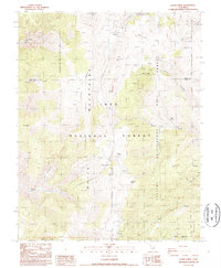
1987 Map of Blanco Mountain
USGS Topo · Published 1987About this map
Ancient Bristlecone Pine Forest defines this high-elevation landscape within the Inyo National Forest, situated along the boundary of Mono and Inyo counties. The area is marked by significant scientific and geological interest, featuring the White Mountain Research Station Crooked Creek Laboratory and the protected stands of Schulman Grove. The terrain is a mix of high peaks like Blanco Mtn and Campito Mountain interspersed with open flats and meadows such as Sage Hen Flat and Big Prospector Meadow.
Find a feature on this map
35 named features on this map. Tap any name to fly to it.
Don’t see what you’re looking for? This feature index may not catch every label — zoom into the map to look around manually.
Map Details
Editions of this 1987 Blanco Mountain Map
2 editions found
Other maps of this area

1913 · Bishop
USGS Topo · 1:125,000

1917 · White Mountain
USGS Topo · 1:125,000

1947 · Mariposa
USGS Topo · 1:250,000

1948 · Mariposa
USGS Topo · 1:250,000

1949 · Bishop
USGS Topo · 1:62,500

1951 · Bishop
USGS Topo · 1:62,500

1951 · Blanco Mountain
USGS Topo · 1:62,500

1957 · Mariposa
USGS Topo · 1:250,000

1962 · Mt. Barcroft
USGS Topo · 1:62,500

1962 · White Mtn. Peak
USGS Topo · 1:62,500