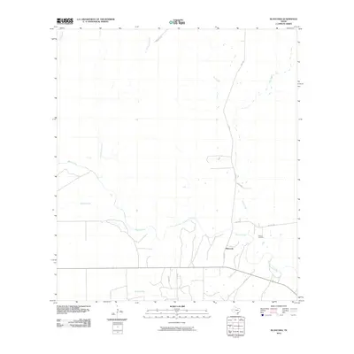
2010 Map of Blanconia
USGS Topo · Published 2010About this map
Blanconia serves as the focal point of this coastal plain landscape, situated where the terrain is defined by a dense network of seasonal and perennial waterways. The prominent Blanco Creek meanders through the lower portion of the map, joined by numerous tributaries including Sarco Creek, Arroyocita Creek, and Murphy Creek. This 2010 survey illustrates a rural Texas environment where local travel relies on a system of farm-to-market roads and county lanes, such as FM 2441, FM 3410, and Co RD 424. For those researching local family history, the McGuill Cemetery stands as a significant landmark east of the main settlement. The land use pattern suggests a traditional ranching or agricultural economy, with widely spaced homesteads and infrastructure like HWY 202 providing the primary connectivity to the broader region beyond these creek-fed pastures.
Find a feature on this map
18 named features on this map. Tap any name to fly to it.
Don’t see what you’re looking for? This feature index may not catch every label — zoom into the map to look around manually.
Map Details
Editions of this 2010 Blanconia Map
This is the sole edition of this map. No revisions or reprints were ever made.
Other maps of this area

1953 · Beeville
USGS Topo · 1:250,000

1954 · Skidmore
USGS Topo · 1:62,500

1954 · Refugio
USGS Topo · 1:62,500

1956 · Beeville
USGS Topo · 1:250,000

1960 · Beeville
USGS Topo · 1:250,000

1962 · Live Oak Lake
USGS Topo · 1:24,000

1962 · Melo
USGS Topo · 1:24,000

1963 · Berclair
USGS Topo · 1:24,000

1978 · Ryanville
USGS Topo · 1:24,000

1978 · Refugio SW
USGS Topo · 1:24,000