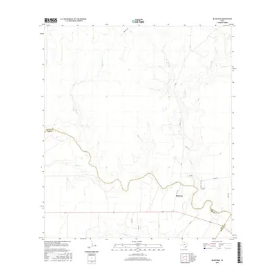
2016 Map of Blanconia
USGS Topo · Published 2016About this map
The community of Blanconia serves as a focal point in this south-central Texas landscape, situated near the winding course of Blanco Cr. This 2016 survey documents a rural environment where drainage networks and property boundaries define the local geography. The map captures the convergence of Bee, Goliad, and Refugio counties, highlighting the intersection of local routes like FM 2441 and Hwy 202. Genealogists and local historians will find the McGuill Cemetery (also marked as McGuill Cem) particularly significant for family research. The terrain is characterized by numerous small waterways, including Arroyocita Cr, Sarco Cr, and Murphy Cr, which shape the ranching and agricultural land. A network of rural roads such as Tuttle Rd and McGuill Rd provides access to the dispersed homesteads and farms of the coastal plains region.
Find a feature on this map
23 named features on this map. Tap any name to fly to it.
Don’t see what you’re looking for? This feature index may not catch every label — zoom into the map to look around manually.
Map Details
Editions of this 2016 Blanconia Map
This is the sole edition of this map. No revisions or reprints were ever made.
Other maps of this area

1953 · Beeville
USGS Topo · 1:250,000

1954 · Skidmore
USGS Topo · 1:62,500

1954 · Refugio
USGS Topo · 1:62,500

1956 · Beeville
USGS Topo · 1:250,000

1960 · Beeville
USGS Topo · 1:250,000

1962 · Live Oak Lake
USGS Topo · 1:24,000

1962 · Melo
USGS Topo · 1:24,000

1963 · Berclair
USGS Topo · 1:24,000

1978 · Ryanville
USGS Topo · 1:24,000

1978 · Refugio SW
USGS Topo · 1:24,000