1949 Map of Bliss
USGS Topo · Published 1978About this map
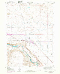
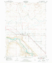
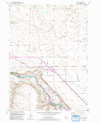
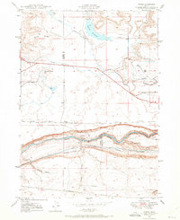
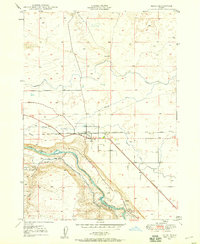
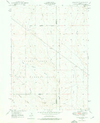
Bliss serves as the central hub of this mid-century Idaho landscape, where the infrastructure of the High Desert meets the dramatic carving of the Snake River canyon. The town's reliance on both rail and water is evident in the path of the Union Pacific railroad and the extensive network of the Main Canal and various Irrigation Ditch segments that crisscross the plateau. Along the river, the Bliss Reservoir marks a significant alteration to the natural flow, while the steep topography is defined by features like Bliss Point and the deep incision of Tuana Gulch. Local history is anchored at the Pioneer Cem and a second Cem located near the tracks. The presence of the King Hill Shoestring Road underscores the importance of connecting these agricultural and transit points across the rugged basalt-rimmed terrain of the Snake River Plain.
Find a feature on this map
14 named features on this map. Tap any name to fly to it.
Don’t see what you’re looking for? This feature index may not catch every label — zoom into the map to look around manually.
Map Details
Editions of this 1949 Bliss Map
4 editions found
Other maps of this area

1892 · Camas Prairie
USGS Topo · 1:125,000

1893 · Camas Prairie
USGS Topo · 1:125,000
1948 · Ticeska
USGS Topo · 1:24,000

1949 · Ticeska
USGS Topo · 1:24,000

1949 · Pasadena Valley
USGS Topo · 1:62,500
1949 · Bliss
USGS Topo · 1:24,000
1949 · Gooding Butte
USGS Topo · 1:24,000
1949 · Tuttle
USGS Topo · 1:24,000
1949 · Hagerman
USGS Topo · 1:24,000
1949 · Indian Butte
USGS Topo · 1:24,000