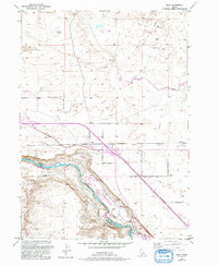
1949 Map of Bliss
USGS Topo · Published 1992About this map
Bliss sits as the central hub of this mid-century landscape, positioned where the Union Pacific railroad tracks bisect the high desert plains. To the south, the terrain drops dramatically into the Hagerman Valley, where the Snake River carves a deep path through the canyon. This area is defined by a complex network of water management, visible in the numerous Canal and Ditch labels that facilitate local agriculture, including several Fish Farms and the Last Chance Reservoir.
Find a feature on this map
28 named features on this map. Tap any name to fly to it.
Don’t see what you’re looking for? This feature index may not catch every label — zoom into the map to look around manually.
Map Details
Editions of this 1949 Bliss Map
4 editions found
Other maps of this area

1892 · Camas Prairie
USGS Topo · 1:125,000

1893 · Camas Prairie
USGS Topo · 1:125,000

1948 · Ticeska
USGS Topo · 1:24,000

1949 · Ticeska
USGS Topo · 1:24,000

1949 · Pasadena Valley
USGS Topo · 1:62,500

1949 · Bliss
USGS Topo · 1:24,000

1949 · Gooding Butte
USGS Topo · 1:24,000

1949 · Tuttle
USGS Topo · 1:24,000

1949 · Hagerman
USGS Topo · 1:24,000

1949 · Indian Butte
USGS Topo · 1:24,000