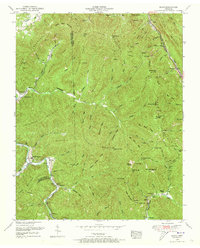
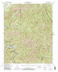
1952 Map of Block
USGS Topo · Published 1973About this map
The Southern railroad line follows the deep valley of Straight Fork in this 1952 survey of the Scott and Campbell County border. This area is characterized by heavy industrial and residential clusters centered around the rail line and the winding path of Tennessee 116, which connects small settlements like Smoky Junction and Turley. The landscape is dominated by massive ridges such as Adkins Mountain and Brushy Mountain, where numerous coal mines and abandoned workings are noted alongside several mountain gaps including Wolf Gap and Flint Gap.
Find a feature on this map
85 named features on this map. Tap any name to fly to it.
Don’t see what you’re looking for? This feature index may not catch every label — zoom into the map to look around manually.
Map Details
Editions of this 1952 Block Map
5 editions found
Other maps of this area

1893 · Briceville
USGS Topo · 1:125,000

1895 · Briceville
USGS Topo · 1:125,000

1896 · Briceville
USGS Topo · 1:125,000

1936 · Hogbell Gap
USGS Topo · 1:24,000

1936 · Ivydell
USGS Topo · 1:24,000

1936 · Block
USGS Topo · 1:24,000

1936 · Jacksboro
USGS Topo · 1:24,000

1936 · Pioneer
USGS Topo · 1:24,000

1936 · Duncan Flats
USGS Topo · 1:24,000

1936 · La Follette
USGS Topo · 1:48,000