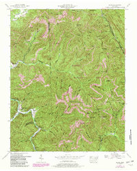
1952 Map of Block
USGS Topo · Published 1980About this map
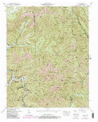
Smoky Creek and the New River converge in the southwest corner of this Campbell and Scott County landscape, defining a region where industrial extraction and conservation lands meet. By the mid-20th century, the terrain was heavily shaped by extensive Strip Mines and Strip Mine operations scattered across Adkins Mountain and Tennessee Mountain. The settlement pattern follows the narrow valleys, with small communities like Turley, Montgomery, and Brookside serving as focal points for local life. Significant portions of the eastern and central sections are designated as the Koppers Brushy Mountain Wildlife Management Area, indicating a shift toward managed natural spaces amidst the legacy of mining. Genealogists will find the Antioch Church and Round Rock Cemetery useful for identifying family sites near Smoky Junction and the surrounding gaps.
Find a feature on this map
103 named features on this map. Tap any name to fly to it.
Don’t see what you’re looking for? This feature index may not catch every label — zoom into the map to look around manually.
Map Details
Editions of this 1952 Block Map
5 editions found
Other maps of this area

1893 · Briceville
USGS Topo · 1:125,000

1895 · Briceville
USGS Topo · 1:125,000

1896 · Briceville
USGS Topo · 1:125,000

1936 · Hogbell Gap
USGS Topo · 1:24,000

1936 · Ivydell
USGS Topo · 1:24,000

1936 · Block
USGS Topo · 1:24,000

1936 · Jacksboro
USGS Topo · 1:24,000

1936 · Pioneer
USGS Topo · 1:24,000

1936 · Duncan Flats
USGS Topo · 1:24,000

1936 · La Follette
USGS Topo · 1:48,000