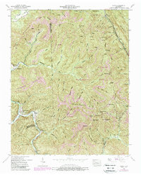
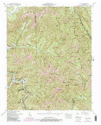
1952 Map of Block
USGS Topo · Published 1988About this map
The Southern Railway winds through this 1952 topographic study, tracing the rugged topography of the Campbell County and Scott County line. The landscape is defined by the heavy footprint of industrial resource extraction, with numerous Strip Mines and several locations simply labeled Strip Mine peppered across the ridges. These industrial operations sit alongside small mountain communities like Smoky Junction and Turley, connected by the rails and the winding course of the New River.
Find a feature on this map
89 named features on this map. Tap any name to fly to it.
Don’t see what you’re looking for? This feature index may not catch every label — zoom into the map to look around manually.
Map Details
Editions of this 1952 Block Map
5 editions found
Other maps of this area

1893 · Briceville
USGS Topo · 1:125,000

1895 · Briceville
USGS Topo · 1:125,000

1896 · Briceville
USGS Topo · 1:125,000

1936 · Hogbell Gap
USGS Topo · 1:24,000

1936 · Ivydell
USGS Topo · 1:24,000

1936 · Block
USGS Topo · 1:24,000

1936 · Jacksboro
USGS Topo · 1:24,000

1936 · Pioneer
USGS Topo · 1:24,000

1936 · Duncan Flats
USGS Topo · 1:24,000

1936 · La Follette
USGS Topo · 1:48,000