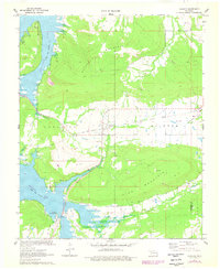
1971 Map of Blocker
USGS Topo · Published 1978About this map
Blocker and its surrounding countryside are captured here during a transitional period in the early 1970s, as the landscape adjusted to the presence of Eufaula Lake. The map reveals a mix of old transport routes and new recreational development, exemplified by the Elm Point Recreation Area along the southern shoreline and Bristow Point to the northwest. The terrain is dominated by the significant elevations of Scaffold Mountain and Blue Mountain, which frame the valleys of Mathuldy Creek and Blue Creek.
Find a feature on this map
22 named features on this map. Tap any name to fly to it.
Don’t see what you’re looking for? This feature index may not catch every label — zoom into the map to look around manually.
Map Details
Editions of this 1971 Blocker Map
4 editions found
Other maps of this area

1898 · McAlester
USGS Topo · 1:125,000

1900 · Sansbois
USGS Topo · 1:125,000

1900 · Canadian
USGS Topo · 1:125,000

1901 · Tuskahoma
USGS Topo · 1:125,000

1908 · Tuskahoma
USGS Topo · 1:125,000

1909 · Mc Alester
USGS Topo · 1:125,000

1909 · Tuskahoma
USGS Topo · 1:125,000

1909 · Sans Bois
USGS Topo · 1:125,000

1911 · Sansbois
USGS Topo · 1:125,000

1946 · Fort Smith
USGS Topo · 1:250,000