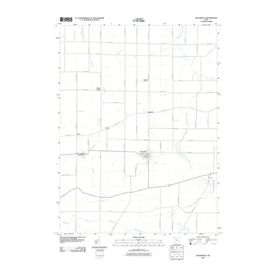
2010 Map of Bloomdale
USGS Topo · Published 2010About this map
The village of Bloomdale and the adjacent settlement of Bairdstown anchor the southern portion of this Wood County landscape, where the local economy is defined by a grid of agricultural roads and drainage systems. The Bloomdale Post Office serves this concentrated community, while the surrounding countryside is dotted with small hamlets like Eagleville and Bloom Center. The terrain is shaped by the subtle movements of the South Branch Portage River and Bull Creek, alongside the engineered pathways of Cessna Ditch. Genealogists will find several burial grounds preserved across the townships, including Chapel Cemetery, Weaver Cemetery, and Ark Cemetery. North of the primary settlements, the McArdle Airport sits along Bloomdale Rd, highlighting the mix of traditional rural life and modern transit. The map records a dense network of township roads, such as Cygnet Rd and Oil Center Rd, which have long connected these farming communities.
Find a feature on this map
53 named features on this map. Tap any name to fly to it.
Don’t see what you’re looking for? This feature index may not catch every label — zoom into the map to look around manually.
Map Details
Editions of this 2010 Bloomdale Map
This is the sole edition of this map. No revisions or reprints were ever made.
Other maps of this area

1901 · Fostoria
USGS Topo · 1:62,500

1901 · Bowling Green
USGS Topo · 1:62,500

1901 · Elmore
USGS Topo · 1:62,500

1903 · Bowling Green
USGS Topo · 1:62,500

1903 · Fostoria
USGS Topo · 1:62,500

1903 · Findlay
USGS Topo · 1:62,500

1903 · Elmore
USGS Topo · 1:62,500

1956 · Toledo
USGS Topo · 1:250,000

1958 · Jerry City
USGS Topo · 1:24,000

1958 · Bowling Green South
USGS Topo · 1:24,000