
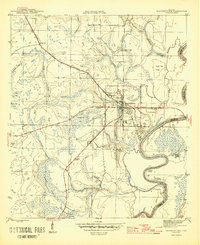
1945 Map of Blountstown
USGS Topo · Published 1945About this map
Blountstown serves as the focal point for this mid-1940s survey of the Florida Panhandle, situated along the western banks of the Apalachicola River. The town is a crossroads of river navigation and rail transport, anchored by the Marianna and Blountstown railroad line. Local industry and land use are evident through features like Flowers Still and Browns Mill Pond, while the Airport north of the town center reflects the era's infrastructure development.
Find a feature on this map
32 named features on this map. Tap any name to fly to it.
Don’t see what you’re looking for? This feature index may not catch every label — zoom into the map to look around manually.
Map Details
Editions of this 1945 Blountstown Map
4 editions found
Other maps of this area

1944 · Clarksville
USGS Topo · 1:31,680

1945 · Clarksville
USGS Topo · 1:31,680

1945 · Estiffanulga
USGS Topo · 1:31,680

1945 · Bristol
USGS Topo · 1:31,680

1945 · Frink
USGS Topo · 1:31,680

1945 · Woods
USGS Topo · 1:31,680

1952 · Altha West
USGS Topo · 1:24,000

1952 · Altha East
USGS Topo · 1:24,000

1954 · Tallahassee
USGS Topo · 1:250,000

1955 · Rock Bluff
USGS Topo · 1:24,000