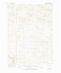
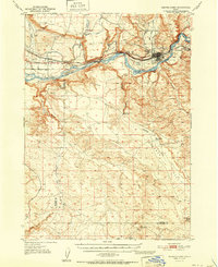
1956 Map of Blue Butte
USGS Topo · Published 1973About this map
Volcanic landforms and military airspace dominate this 1950s Owyhee County landscape, where the Aerial Gunnery Range spans a large portion of the high desert plateau. Distinctive basaltic landmarks such as Blue Butte, Notch Butte, and Soldier Cap Butte rise above the surrounding terrain, serving as essential reference points in a region defined by its isolation. The map captures an era when the Air Force Reservation Boundary demarcated the land for strategic use, while cattlemen and travelers relied on the Castleford Road and Crows Nest Road to navigate the expanse.
Find a feature on this map
20 named features on this map. Tap any name to fly to it.
Don’t see what you’re looking for? This feature index may not catch every label — zoom into the map to look around manually.
Map Details
Editions of this 1956 Blue Butte Map
2 editions found

Other maps of this area

1948 · Indian Cove
USGS Topo · 1:62,500

1948 · Twentymile Butte
USGS Topo · 1:24,000

1948 · Glenns Ferry
USGS Topo · 1:62,500

1948 · Pence Butte
USGS Topo · 1:24,000

1948 · Grindstone Butte
USGS Topo · 1:24,000
1949 · Pot Hole Canyon
USGS Topo · 1:24,000
1949 · Grindstone Butte
USGS Topo · 1:24,000
1949 · Pence Butte
USGS Topo · 1:24,000

1949 · Pasadena Valley
USGS Topo · 1:62,500
1951 · Glenns Ferry
USGS Topo · 1:62,500