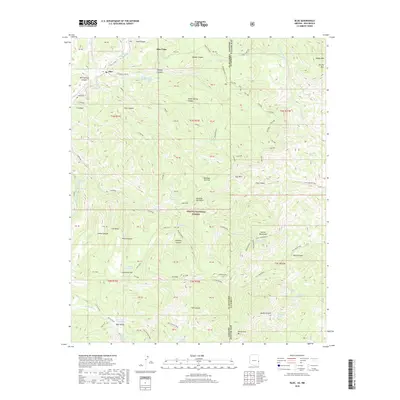
2018 Map of Blue
USGS Topo · Published 2018About this map
The Blue River corridor in eastern Arizona serves as the central artery for this high-elevation landscape within the Apache National Forest. Located along the boundary between Greenlee County, Arizona and Catron County, New Mexico, the region is defined by deep canyons and prominent overlooks. Small settlements like Blue and Blue Vista are connected by a network of forest roads and trails, including Pueblo Park Rd and the Tige Canyon Trail. Local family history is centered near Jones Cem, while the geography is punctuated by significant landmarks such as Devil's Monument and Whiterock Mtn. Significant water sources like Stateline Tank and Bear Valley Cabin Spring indicate the essential water management required in this remote terrain, where canyon systems like Lanphier Canyon and Dam Canyon carve through the high plateaus.
Find a feature on this map
81 named features on this map. Tap any name to fly to it.
Don’t see what you’re looking for? This feature index may not catch every label — zoom into the map to look around manually.
Map Details
Editions of this 2018 Blue Map
This is the sole edition of this map. No revisions or reprints were ever made.
Other maps of this area

1910 · Mogollon
USGS Topo · 1:125,000

1912 · Mogollon
USGS Topo · 1:125,000

1913 · Morenci
USGS Topo · 1:125,000

1915 · Morenci
USGS Topo · 1:125,000

1915 · Reserve
USGS Topo · 1:125,000

1918 · Reserve
USGS Topo · 1:125,000

1922 · Nutrioso
USGS Topo · 1:125,000

1954 · Clifton
USGS Topo · 1:250,000

1957 · Clifton
USGS Topo · 1:250,000

1958 · Clifton
USGS Topo · 1:250,000