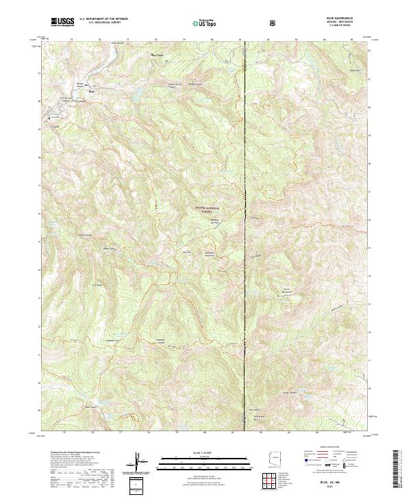
2021 Map of Blue
USGS Topo · Published 2021About this map
The Blue River carves a deep path through the Apache National Forest on this survey of the high country along the Arizona and New Mexico border. The small community of Blue and nearby Blue Vista serve as the primary human touchpoints in a landscape dominated by dramatic vertical relief and complex drainage systems. Notable landmarks like Devils Monument and Whiterocks Mtn rise above a network of canyons, including Cow Canyon and Lanphier Canyon. For those researching local history or genealogy, the Jones Cem is a significant site located near the river. The map details an extensive system of primitive routes such as the Bonanza Bill Trl and Tige Rim Trl, which connect high points like Bonanza Bill Point to vital water sources like Campbell Flat Lake and Bear Valley Cabin Spring.
Find a feature on this map
84 named features on this map. Tap any name to fly to it.
Don’t see what you’re looking for? This feature index may not catch every label — zoom into the map to look around manually.
Map Details
Editions of this 2021 Blue Map
This is the sole edition of this map. No revisions or reprints were ever made.
Other maps of this area

1910 · Mogollon
USGS Topo · 1:125,000

1912 · Mogollon
USGS Topo · 1:125,000

1913 · Morenci
USGS Topo · 1:125,000

1915 · Morenci
USGS Topo · 1:125,000

1915 · Reserve
USGS Topo · 1:125,000

1918 · Reserve
USGS Topo · 1:125,000

1922 · Nutrioso
USGS Topo · 1:125,000

1954 · Clifton
USGS Topo · 1:250,000

1957 · Clifton
USGS Topo · 1:250,000

1958 · Clifton
USGS Topo · 1:250,000