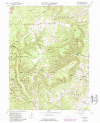
1963 Map of Blue Knob
USGS Topo · Published 1988About this map
Blue Knob State Park anchors this central Pennsylvania landscape, dominated by the high elevations of Blue Knob and its surrounding peaks. The map reveals a mountain-and-valley settlement pattern where small communities like Fredericksburg, Pavia, and Queen reside alongside the headwaters of Bobs Creek and Beaverdam Creek. The 1980s updates, shown in purple, document the development of the Ski Area and Golf Course on the mountain's eastern slopes, contrasting with the preservation of State Game Lands No 26 to the west. For local historians and genealogists, the sheet is particularly valuable for its documentation of family-named landmarks and rural infrastructure, including Stiefler Cemetery, the Lost Oak Children Monument, and several community houses of worship such as Mt Moriah Church and Upper Claar Church. The presence of a Strip Mine in the northern reaches near Washington township highlights the legacy of resource extraction in this part of the Allegheny Front.
Find a feature on this map
78 named features on this map. Tap any name to fly to it.
Don’t see what you’re looking for? This feature index may not catch every label — zoom into the map to look around manually.
Map Details
Editions of this 1963 Blue Knob Map
4 editions found
Other maps of this area

1900 · Everett
USGS Topo · 1:62,500

1902 · Everett
USGS Topo · 1:62,500

1902 · Ebensburg
USGS Topo · 1:62,500

1902 · Hollidaysburg
USGS Topo · 1:62,500

1903 · Hollidaysburg
USGS Topo · 1:62,500

1904 · Ebensburg
USGS Topo · 1:62,500

1908 · Bedford
USGS Topo · 1:62,500

1910 · Bedford
USGS Topo · 1:62,500

1953 · Pittsburgh
USGS Topo · 1:250,000

1954 · Pittsburgh
USGS Topo · 1:250,000
Featured Places
- Pavia Township, PA
- Freedom Township, PA
- Greenfield Township, PA
- Blue Knob, Juniata Township
- Washington Township, PA