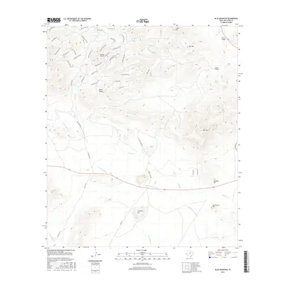
2016 Map of Blue Mountain
USGS Topo · Published 2016About this map
Limpia Mtn and Blue Mtn anchor this high-elevation landscape in the Davis Mountains during the mid-2010s. The terrain is defined by a dense network of specialized trails and passes, including Stage Coach Pass, Bandolero Pass, and the Arrowhead Pass Trl, suggesting a focus on recreational or ranching access rather than industrial development. Water is managed through localized sources such as Santana Tank and Webster Tank, which support the drainages of Cienega Cr and its various forks. Large ranching interests are evident through the presence of Friend Ranch Rd and Largent Ranch Rd, illustrating the continued importance of private landholdings in this part of Jeff Davis County. The map provides clear detail for tracing modern access through Limpia Canyon and the surrounding peaks like Deer Mtn and Carpenter Mtn.
Find a feature on this map
56 named features on this map. Tap any name to fly to it.
Don’t see what you’re looking for? This feature index may not catch every label — zoom into the map to look around manually.
Map Details
Editions of this 2016 Blue Mountain Map
This is the sole edition of this map. No revisions or reprints were ever made.
Other maps of this area

1894 · Valentine
USGS Topo · 1:125,000

1894 · Fort Davis
USGS Topo · 1:125,000

1895 · Marfa
USGS Topo · 1:125,000

1895 · Alpine
USGS Topo · 1:125,000

1897 · Valentine
USGS Topo · 1:125,000

1897 · Fort Davis
USGS Topo · 1:125,000

1943 · Valentine
USGS Topo · 1:125,000

1954 · Fort Stockton
USGS Topo · 1:250,000

1958 · Fort Stockton
USGS Topo · 1:250,000

1959 · Marfa
USGS Topo · 1:250,000