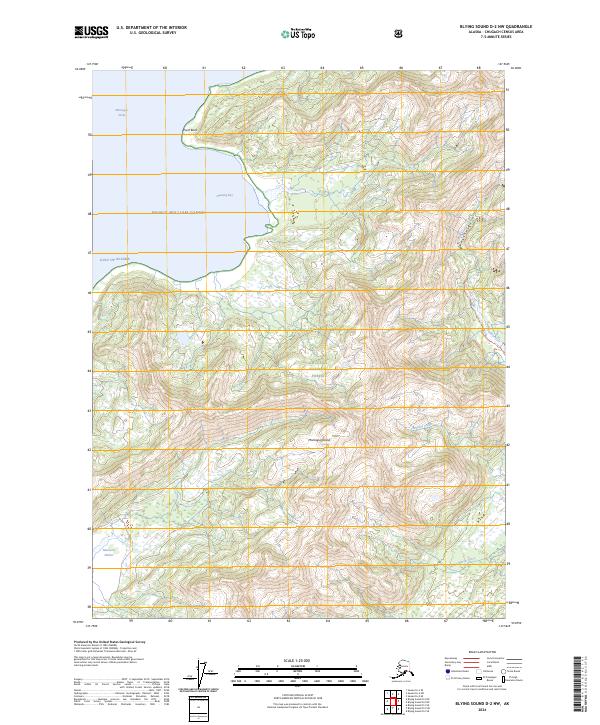
2024 Map of Blying Sound D-2 NW
USGS Topo · Published 2024About this map
Montague Island dominates this portion of the Kenai Peninsula, where the landscape is defined by the wilderness of the Chugach National Forest. The coastline is deeply indented by maritime features such as Hanning Bay and MacLeod Harbor, providing sheltered waters away from the open Gulf of Alaska. The interior topography is marked by significant drainage systems, including the Patton River and its accompanying Patton River Trl, which offer a glimpse into the primitive transport routes through this heavily forested and mountainous terrain. The map captures a landscape largely untouched by permanent settlement, where water bodies like Braided Creek and the Nellie Martin River dictate the movement of anyone traversing the island's western reaches. The presence of Point Bazil at the northern tip of Hanning Bay serves as a primary coastal landmark for those navigating the Montague Strait.
Find a feature on this map
16 named features on this map. Tap any name to fly to it.
Don’t see what you’re looking for? This feature index may not catch every label — zoom into the map to look around manually.
Map Details
Editions of this 2024 Blying Sound D-2 NW Map
This is the sole edition of this map. No revisions or reprints were ever made.
Other maps of this area

1946 · Blying Sound
USGS Topo · 1:250,000

1951 · Blying Sound
USGS Topo · 1:250,000

1951 · Seward
USGS Topo · 1:250,000

1951 · Seward A-2
USGS Topo · 1:63,360

1951 · Seward A-3
USGS Topo · 1:63,360

1951 · Blying Sound D-1 and D-2
USGS Topo · 1:63,360

1952 · Seward A-3
USGS Topo · 1:63,360

1953 · Seward A-2
USGS Topo · 1:63,360
1953 · Blying Sound D-3
USGS Topo · 1:63,360
1953 · Blying Sound D-1 and D-2
USGS Topo · 1:63,360