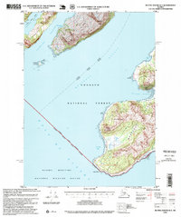
1995 Map of Blying Sound D-3
USGS Topo · Published 1999About this map
Montague Island and Latouche Island anchor this coastal survey, where the deep waters of Montague Strait meet the open Gulf of Alaska. The landscape is defined by the intersection of the Chugach National Forest and the Alaska Maritime National Wildlife Refuge, reflecting a mid-1990s period of federal land management and resource preservation. Near Point Woodcock, the presence of a Log Transfer Facility in Mac Leod Harbor indicates the area's industrial ties to timber, even as much of the surrounding terrain remains undeveloped. Navigational markers like the Light on Evans Island and the Alaska Marine Highway route through Elrington Passage emphasize the region's reliance on maritime transport. For those interested in remote backcountry infrastructure, the San Juan Bay Cabin (FS) is noted near the southern tip of Montague Island at San Juan Bay.
Find a feature on this map
25 named features on this map. Tap any name to fly to it.
Don’t see what you’re looking for? This feature index may not catch every label — zoom into the map to look around manually.
Map Details
Editions of this 1995 Blying Sound D-3 Map
This is the sole edition of this map. No revisions or reprints were ever made.
Other maps of this area

1946 · Blying Sound
USGS Topo · 1:250,000

1950 · Blying Sound D-4
USGS Topo · 1:63,360

1951 · Blying Sound
USGS Topo · 1:250,000

1951 · Seward
USGS Topo · 1:250,000

1951 · Seward A-2
USGS Topo · 1:63,360

1951 · Seward A-3
USGS Topo · 1:63,360

1951 · Blying Sound D-1 and D-2
USGS Topo · 1:63,360

1951 · Seward A-4
USGS Topo · 1:63,360

1952 · Seward A-3
USGS Topo · 1:63,360

1952 · Seward A-4
USGS Topo · 1:63,360