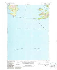
1950 Map of Blying Sound D-4
USGS Topo · Published 1988About this map
Elrington Island and Evans Island anchor this coastal survey, where the waters of the Gulf of Alaska meet the rugged coastline of the Kenai Peninsula. The map highlights critical navigational landmarks including a designated Lighthouse Reserve and Light at Lonetree Pt, as well as another reserve at Pt Elrington. The coastal geography is defined by deep inlets such as Puget Bay and Port Bainbridge, separated by high ridges and prominent landforms like Cape Puget.
Find a feature on this map
21 named features on this map. Tap any name to fly to it.
Don’t see what you’re looking for? This feature index may not catch every label — zoom into the map to look around manually.
Map Details
Editions of this 1950 Blying Sound D-4 Map
3 editions found
Other maps of this area

1946 · Blying Sound
USGS Topo · 1:250,000

1950 · Blying Sound D-4
USGS Topo · 1:63,360

1950 · Blying Sound D-5
USGS Topo · 1:63,360

1951 · Blying Sound
USGS Topo · 1:250,000

1951 · Seward
USGS Topo · 1:250,000

1951 · Seward A-5
USGS Topo · 1:63,360

1951 · Seward A-3
USGS Topo · 1:63,360

1951 · Seward A-4
USGS Topo · 1:63,360

1952 · Seward A-5
USGS Topo · 1:63,360

1952 · Seward A-3
USGS Topo · 1:63,360