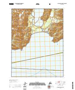
2018 Map of Blying Sound D-5 NW
USGS Topo · Published 2018About this map
Big Johnstone Lake sits as the central focal point of this coastal landscape, separated from the waters of Johnstone Bay by a narrow barrier beach. This 2018 survey reveals the wild, unpopulated character of the Kenai Peninsula Borough Valdez-Cordova Census Area, where the coastline is defined by dramatic features like Cape Fairfield and Pinnacle Rock. The territory is almost entirely comprised of managed public lands, split between the Chugach National Forest in the interior and the Alaska Maritime National Wildlife Refuge along the eastern shoreline.
Find a feature on this map
13 named features on this map. Tap any name to fly to it.
Don’t see what you’re looking for? This feature index may not catch every label — zoom into the map to look around manually.
Map Details
Editions of this 2018 Blying Sound D-5 NW Map
This is the sole edition of this map. No revisions or reprints were ever made.
Other maps of this area

1946 · Blying Sound
USGS Topo · 1:250,000

1950 · Seward A-6
USGS Topo · 1:63,360

1950 · Blying Sound D-6
USGS Topo · 1:63,360

1950 · Blying Sound D-5
USGS Topo · 1:63,360

1951 · Blying Sound
USGS Topo · 1:250,000

1951 · Seward
USGS Topo · 1:250,000

1951 · Seward A-6
USGS Topo · 1:63,360

1951 · Seward A-5
USGS Topo · 1:63,360

1952 · Seward A-5
USGS Topo · 1:63,360
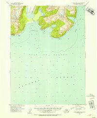
1952 · Blying Sound D-5
USGS Topo · 1:63,360