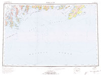
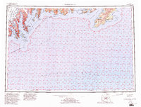
1953 Map of Blying Sound
USGS Topo · Published 1974About this map
The Harding Icefield dominates the western interior of this coastal survey, serving as the massive source for the Aialik Glacier, Pederson Glacier, and Holgate Glacier. These ice flows carve deep into the Kenai Mountains, creating the dramatic fjords of Aialik Bay and Harris Bay. The map captures the intricate shoreline of the Kenai Peninsula at a time when these glacial systems and their terminal moraines dictated the maritime access points to the region's interior.
Find a feature on this map
38 named features on this map. Tap any name to fly to it.
Don’t see what you’re looking for? This feature index may not catch every label — zoom into the map to look around manually.
Map Details
Editions of this 1953 Blying Sound Map
6 editions found

Other maps of this area

1944 · Kenai
USGS Topo · 1:250,000

1946 · Blying Sound
USGS Topo · 1:250,000

1948 · Cordova
USGS Topo · 1:250,000

1948 · Middleton Island
USGS Topo · 1:250,000

1950 · Kenai
USGS Topo · 1:250,000

1950 · Middleton Island
USGS Topo · 1:250,000

1950 · Seward A-6
USGS Topo · 1:63,360

1950 · Seward A-8
USGS Topo · 1:63,360

1950 · Blying Sound D-7
USGS Topo · 1:63,360

1950 · Blying Sound D-6
USGS Topo · 1:63,360