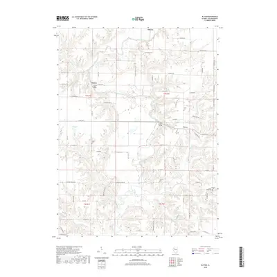
2018 Map of Blyton
USGS Topo · Published 2018About this map
The Spoon River meanders through the heart of this Fulton County landscape, carving a valley that separates the rural settlements of Babylon and Blyton. This area is characterized by a dense network of country roads, including the uniquely named E Dogpatch Rd and E Turtle Shell Rd, which connect scattered farms and local landmarks. The riparian terrain along Put Creek and Turkey Cr provides a glimpse into the hydraulic patterns that shaped local development in this part of Illinois. For those investigating regional history or genealogy, several small burial grounds are documented, such as Wiley Cem and Sinnett Chapel Cem. Civil engineering of the era is evident at the Babylon Bend Bridge and Ziltz Bridge, which provide critical crossings over the region's main waterways. The map also captures the topography of Big Hollow and the drainage of Aylesworth Br into the larger river system.
Find a feature on this map
77 named features on this map. Tap any name to fly to it.
Don’t see what you’re looking for? This feature index may not catch every label — zoom into the map to look around manually.
Map Details
Editions of this 2018 Blyton Map
This is the sole edition of this map. No revisions or reprints were ever made.
Other maps of this area

1912 · Canton
USGS Topo · 1:62,500

1915 · Avon
USGS Topo · 1:62,500

1918 · Vermont
USGS Topo · 1:62,500

1921 · Vermont
USGS Topo · 1:62,500

1925 · Havana
USGS Topo · 1:62,500

1944 · Avon
USGS Topo · 1:62,500

1947 · Lewistown
USGS Topo · 1:24,000

1947 · Adair
USGS Topo · 1:24,000

1948 · Lewistown
USGS Topo · 1:24,000
1948 · Adair
USGS Topo · 1:24,000