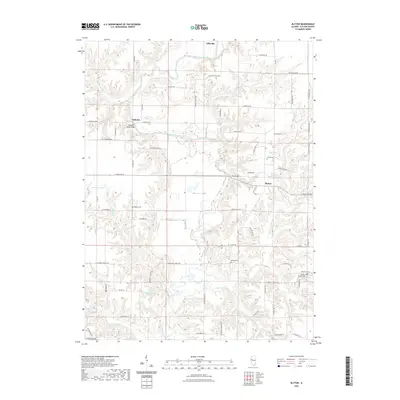
2021 Map of Blyton
USGS Topo · Published 2021About this map
Spoon River meanders through the central terrain of this Fulton County region, defining a landscape of deep drainage basins like Big Hollow and numerous tributary creeks. The small community of Ellisville sits at the northern edge, while the settlement of Babylon is positioned near the western bends of the river. The map documents a predominantly rural infrastructure connected by a network of named local roads, including E Buckeye Church Rd and N Baughman School Rd, which reflect the area's social history through their proximity to landmarks like Buckeye Cem.
Find a feature on this map
73 named features on this map. Tap any name to fly to it.
Don’t see what you’re looking for? This feature index may not catch every label — zoom into the map to look around manually.
Map Details
Editions of this 2021 Blyton Map
This is the sole edition of this map. No revisions or reprints were ever made.
Other maps of this area

1912 · Canton
USGS Topo · 1:62,500

1915 · Avon
USGS Topo · 1:62,500

1918 · Vermont
USGS Topo · 1:62,500

1921 · Vermont
USGS Topo · 1:62,500

1925 · Havana
USGS Topo · 1:62,500

1944 · Avon
USGS Topo · 1:62,500

1947 · Lewistown
USGS Topo · 1:24,000

1947 · Adair
USGS Topo · 1:24,000

1948 · Lewistown
USGS Topo · 1:24,000
1948 · Adair
USGS Topo · 1:24,000