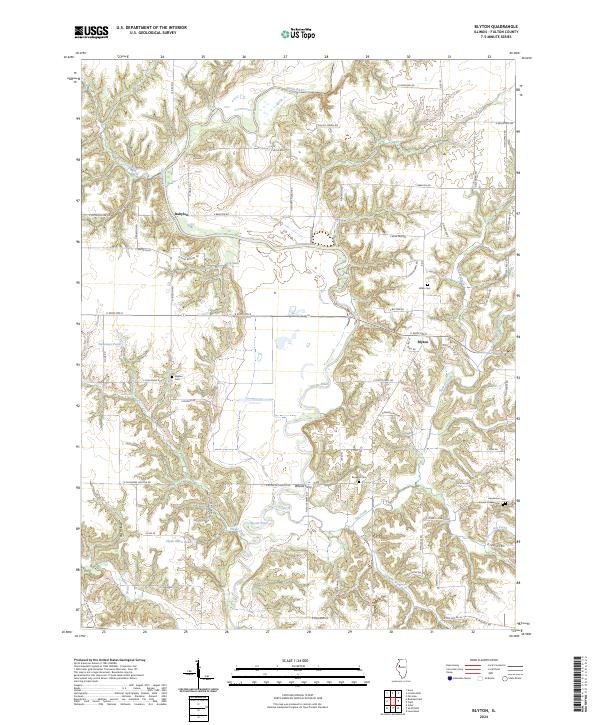
2024 Map of Blyton
USGS Topo · Published 2024About this map
The Spoon River carves a deep path through Fulton County, anchoring a landscape defined by its riparian geometry and small rural crossings. Settlement clusters at Babylon and Blyton are joined by the historical crossing point at Whites Ferry, reflecting an era when river transit dictated the local geography. The upland areas are marked by several family and community burial grounds, including the Henderson Cem and Sinnett Chapel Cem near Put Creek, providing essential locations for genealogical research. Numerous small tributaries and local impoundments like Sweeneys Pond and Clyde Darst Pond pocket the terrain. The road network, often following section lines, features descriptive local names such as E Bear Paw Rd and N Rattlesnake Rd, which hint at the traditional character of the surrounding countryside.
Find a feature on this map
72 named features on this map. Tap any name to fly to it.
Don’t see what you’re looking for? This feature index may not catch every label — zoom into the map to look around manually.
Map Details
Editions of this 2024 Blyton Map
This is the sole edition of this map. No revisions or reprints were ever made.
Other maps of this area

1912 · Canton
USGS Topo · 1:62,500

1915 · Avon
USGS Topo · 1:62,500

1918 · Vermont
USGS Topo · 1:62,500

1921 · Vermont
USGS Topo · 1:62,500

1925 · Havana
USGS Topo · 1:62,500

1944 · Avon
USGS Topo · 1:62,500

1947 · Lewistown
USGS Topo · 1:24,000

1947 · Adair
USGS Topo · 1:24,000

1948 · Lewistown
USGS Topo · 1:24,000
1948 · Adair
USGS Topo · 1:24,000