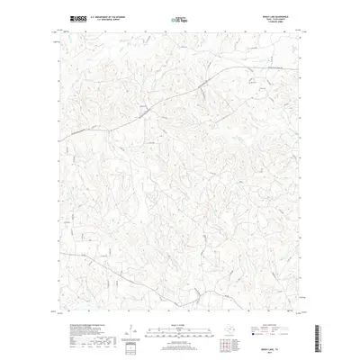
2019 Map of Boggy Lake
USGS Topo · Published 2019About this map
Davis Cem, Gregory Cem, and Grimes Cem provide important geographic anchors for genealogists and local historians exploring this rural portion of Tyler County. The landscape is defined by a dense network of watercourses, including the notable Tompkins Mill Cr and Henson-Mill Cr, which suggest historical mill locations along their banks. The southern portion of the area is traversed by FM 256, while the interior is accessible via a web of numbered county roads like Co RD 3750 and Co RD 3260. Significant drainage systems such as Clear Fork Creek and Sugar Cr carve through the terrain, illustrating the hydrologic character of the East Texas timberlands. This recent survey captures the modern road infrastructure and preserved cemetery sites that connect today's landscape to its long-standing rural community roots.
Find a feature on this map
60 named features on this map. Tap any name to fly to it.
Don’t see what you’re looking for? This feature index may not catch every label — zoom into the map to look around manually.
Map Details
Editions of this 2019 Boggy Lake Map
This is the sole edition of this map. No revisions or reprints were ever made.
Other maps of this area

1928 · Zavalla 3-c
USGS Topo · 1:24,000

1931 · Zavalla
USGS Topo · 1:62,500

1953 · Palestine
USGS Topo · 1:250,000

1954 · Beaumont
USGS Topo · 1:250,000

1955 · Woodville
USGS Topo · 1:62,500

1955 · Curtis
USGS Topo · 1:62,500

1957 · Beaumont
USGS Topo · 1:250,000

1957 · Palestine
USGS Topo · 1:250,000

1958 · Zavalla
USGS Topo · 1:62,500

1958 · Mc Gee Bend
USGS Topo · 1:62,500