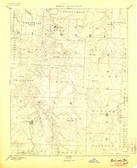
1892 Map of Bolivar
USGS Topo · Published 1906About this map
The Bolivar and Buffalo areas of Southwest Missouri are captured here during a period of transition as these county seats anchored their respective rural districts. The landscape is defined by the winding course of the Pomme De Terre River and the Niangua River, which shaped the early development of Hickory and Polk counties. Small agricultural centers and post offices like Hermitage, Urbana, and Wheatland serve as the primary hubs for the surrounding townships. Local commerce of the era is evidenced by features such as Parks Mill on the Little Niangua River, while the network of roads connects now-scattered sites including Sentinel Prairie, Rondo, and Greasy. The detailed topography reveals the many creeks and branches—such as Slinking Creek and Cahoochee Creek—that dictated the placement of homesteads and early cross-country paths.
Find a feature on this map
57 named features on this map. Tap any name to fly to it.
Don’t see what you’re looking for? This feature index may not catch every label — zoom into the map to look around manually.
Map Details
Editions of this 1892 Bolivar Map
5 editions found
Other maps of this area

1884 · Springfield
USGS Topo · 1:125,000

1884 · Bolivar
USGS Topo · 1:125,000

1886 · Stockton
USGS Topo · 1:125,000

1886 · Greenfield
USGS Topo · 1:125,000

1886 · Springfield
USGS Topo · 1:125,000

1887 · Clinton
USGS Topo · 1:125,000

1887 · Warsaw
USGS Topo · 1:125,000

1888 · Versailles
USGS Topo · 1:125,000

1888 · Greenfield
USGS Topo · 1:125,000

1892 · Bolivar
USGS Topo · 1:125,000