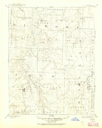
1892 Map of Bolivar
USGS Topo · Published 1950About this map
Bolivar and Buffalo serve as the primary hubs in this late nineteenth-century reconnaissance survey, which captures the rural character of Polk, Hickory, and Dallas counties. The landscape is defined by the winding course of the Pomme de Terre River and the Niangua River, which shaped the early settlement patterns of the Ozark Plateau. Away from the larger towns, the map documents numerous small communities such as Elkton, Urbana, and Louisburg, alongside descriptive locales like Sentinel Prairie and Black Oak.
Find a feature on this map
57 named features on this map. Tap any name to fly to it.
Don’t see what you’re looking for? This feature index may not catch every label — zoom into the map to look around manually.
Map Details
Editions of this 1892 Bolivar Map
5 editions found
Other maps of this area

1884 · Springfield
USGS Topo · 1:125,000

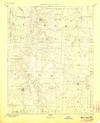
1884 · Bolivar
USGS Topo · 1:125,000

1886 · Stockton
USGS Topo · 1:125,000

1886 · Greenfield
USGS Topo · 1:125,000

1886 · Springfield
USGS Topo · 1:125,000

1887 · Clinton
USGS Topo · 1:125,000

1887 · Warsaw
USGS Topo · 1:125,000

1888 · Versailles
USGS Topo · 1:125,000

1888 · Greenfield
USGS Topo · 1:125,000

1892 · Bolivar
USGS Topo · 1:125,000