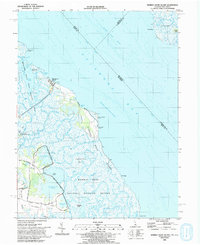
1993 Map of Bombay Hook Island
USGS Topo · Published 1993About this map
Bombay Hook National Wildlife Refuge dominates this coastal landscape along the Delaware Bay, revealing a complex environment of tidal marshes, pools, and managed wetlands. The map shows the intricate drainage patterns of Duck Creek and the Leipsic River, which carve through the Money Marsh and Leatherbury Flats. Managed impoundments like Raymond Pool, Shearness Pool, and Bear Swamp Pool highlight the region's focus on migratory bird habitat conservation during the late 20th century.
Find a feature on this map
55 named features on this map. Tap any name to fly to it.
Don’t see what you’re looking for? This feature index may not catch every label — zoom into the map to look around manually.
Map Details
Editions of this 1993 Bombay Hook Island Map
This is the sole edition of this map. No revisions or reprints were ever made.
Other maps of this area

1890 · Bay Side
USGS Topo · 1:62,500

1894 · Bay Side
USGS Topo · 1:62,500

1899 · Vineland
USGS Topo · 1:125,000

1899 · Dover
USGS Topo · 1:125,000

1906 · Dover
USGS Topo · 1:125,000

1919 · Vineland
USGS Topo · 1:125,000

1920 · Dover
USGS Topo · 1:125,000

1926 · Wyoming
USGS Topo · 1:48,000

1930 · Wyoming
USGS Topo · 1:62,500

1931 · Wyoming
USGS Topo · 1:62,500