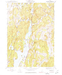
1944 Map of Bomoseen
USGS Topo · Published 1977About this map
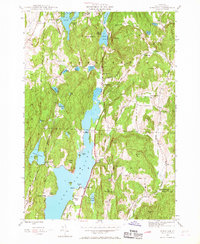
Bomoseen Lake dominates this landscape, reflecting a mid-20th-century mix of seasonal camps and established rural communities. The map highlights a network of recreational clusters such as Beechwood Camp, Green Mtn Camp, and Eagle Rock Camp, which sit alongside historic farmsteads and crossroads. In Hubbardton, the presence of the Monument near Turnpike Sch serves as a reminder of the area's Revolutionary War history, while the surrounding hills like Zion Hill and Eaton Hill define the rugged topography.
Find a feature on this map
64 named features on this map. Tap any name to fly to it.
Don’t see what you’re looking for? This feature index may not catch every label — zoom into the map to look around manually.
Map Details
Editions of this 1944 Bomoseen Map
5 editions found
Other maps of this area

1893 · Whitehall
USGS Topo · 1:62,500

1894 · Ticonderoga
USGS Topo · 1:62,500

1895 · Whitehall
USGS Topo · 1:62,500

1895 · Castleton
USGS Topo · 1:62,500

1896 · Ticonderoga
USGS Topo · 1:62,500

1897 · Castleton
USGS Topo · 1:62,500

1898 · Whitehall
USGS Topo · 1:62,500

1902 · Whitehall
USGS Topo · 1:62,500

1902 · Ticonderoga
USGS Topo · 1:62,500

1902 · Brandon
USGS Topo · 1:62,500