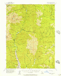
1955 Map of Bonanza King
USGS Topo · Published 1957About this map
Bonanza King looms over the headwaters of the Trinity River in this mid-century look at Northern California's mining and ranching country. The landscape is a network of remote holdings and high-altitude industry, with historical sites like the Bonanza King Mine and the Altoona Mine nestled within the Shasta National Forest. Settlement is concentrated along the river corridor, where the communities of Carville, Stringtown, and Trinity Center serve as local hubs.
Find a feature on this map
111 named features on this map. Tap any name to fly to it.
Don’t see what you’re looking for? This feature index may not catch every label — zoom into the map to look around manually.
Map Details
Editions of this 1955 Bonanza King Map
4 editions found
Other maps of this area

1886 · Shasta
USGS Topo · 1:250,000

1890 · Red Bluff
USGS Topo · 1:250,000

1894 · Red Bluff
USGS Topo · 1:250,000

1894 · Shasta
USGS Topo · 1:250,000

1901 · Redding
USGS Topo · 1:125,000

1913 · Weaverville
USGS Topo · 1:125,000

1923 · Sawyers Bar
USGS Topo · 1:125,000

1931 · Etna
USGS Topo · 1:96,000

1934 · Etna
USGS Topo · 1:125,000

1935 · Dunsmuir
USGS Topo · 1:125,000