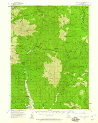
1955 Map of Bonanza King
USGS Topo · Published 1960About this map
Trinity River gold country and the high ridges of the Shasta Trinity National Forest define this mid-century survey. The settlement at Trinity Center anchors the southern portion of the map, situated along the river near a Landing Strip and Tailings that mark the local mining history. Further north, the river valley passes through Stringtown and Carrville, which served as key nodes for the surrounding mountain ranches and wilderness cabins.
Find a feature on this map
98 named features on this map. Tap any name to fly to it.
Don’t see what you’re looking for? This feature index may not catch every label — zoom into the map to look around manually.
Map Details
Editions of this 1955 Bonanza King Map
4 editions found
Other maps of this area

1886 · Shasta
USGS Topo · 1:250,000

1890 · Red Bluff
USGS Topo · 1:250,000

1894 · Red Bluff
USGS Topo · 1:250,000

1894 · Shasta
USGS Topo · 1:250,000

1901 · Redding
USGS Topo · 1:125,000

1913 · Weaverville
USGS Topo · 1:125,000

1923 · Sawyers Bar
USGS Topo · 1:125,000

1931 · Etna
USGS Topo · 1:96,000

1934 · Etna
USGS Topo · 1:125,000

1935 · Dunsmuir
USGS Topo · 1:125,000