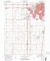
1970 Map of Bondville
USGS Topo · Published 1976About this map
Champaign city expansion dominates the eastern portion of this map, reflecting the post-war growth that reshaped the Illinois prairie. The suburban frontier moves westward past the Illinois Central Terminal and into the small settlements of Staley and Kenwood, while the southern reaches are anchored by the University of Illinois-Willard Airport. This survey captures a transitional landscape where established institutional landmarks like Cole Hospital and St Matthews Sch meet the emerging residential developments around Hessel Park and Morrissey Park.
Find a feature on this map
57 named features on this map. Tap any name to fly to it.
Don’t see what you’re looking for? This feature index may not catch every label — zoom into the map to look around manually.
Map Details
Editions of this 1970 Bondville Map
2 editions found
Other maps of this area

1906 · Urbana
USGS Topo · 1:62,500

1907 · Mahomet
USGS Topo · 1:62,500

1950 · Tuscola
USGS Topo · 1:62,500

1956 · Villa Grove
USGS Topo · 1:62,500

1957 · Urbana
USGS Topo · 1:62,500

1957 · Urbana
USGS Topo · 1:24,000

1957 · Rising
USGS Topo · 1:24,000

1957 · Mahomet
USGS Topo · 1:62,500

1957 · Bondville
USGS Topo · 1:24,000
1957 · Thomasboro
USGS Topo · 1:24,000