
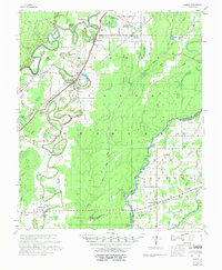
1958 Map of Bonita
USGS Topo · Published 1958About this map
The agricultural plains of Morehouse Parish and West Carroll Parish are defined by an intricate network of waterways, including Bartholomew Bayou, Bonne Idee Bayou, and the Boeuf River. This late-1950s landscape shows the transition from smaller family-named landmarks to a more consolidated rural economy. The Missouri Pacific Railroad bisects the region, connecting the primary settlements of Jones and Bonita. The map is particularly dense with community infrastructure, showing numerous small churches such as Victory Missionary Ch and Little Zion Ch that served as local anchors. For researchers, the presence of specific institutions like McGloty Sch New Hope Ch and the distinctively named 12 Heart Cem provides excellent detail for locating specific homesteads or community centers that may have shifted or changed over the decades.
Find a feature on this map
53 named features on this map. Tap any name to fly to it.
Don’t see what you’re looking for? This feature index may not catch every label — zoom into the map to look around manually.
Map Details
Editions of this 1958 Bonita Map
2 editions found
Other maps of this area

1935 · Collinston
USGS Topo · 1:62,500

1935 · Wilmot
USGS Topo · 1:62,500

1935 · Naff
USGS Topo · 1:62,500

1935 · Hurricane
USGS Topo · 1:62,500

1935 · Oak Grove
USGS Topo · 1:62,500

1935 · Bonita
USGS Topo · 1:62,500

1936 · Eudora
USGS Topo · 1:62,500

1953 · Greenwood
USGS Topo · 1:250,000

1955 · Jackson
USGS Topo · 1:250,000

1956 · Greenwood
USGS Topo · 1:250,000