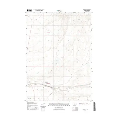
2015 Map of Bonneville
USGS Topo · Published 2015About this map
Bonneville sits at the center of this Wyoming landscape, where the flat drainage plains of Badwater Creek meet the high desert topography of Fremont County. The settlement patterns follow the corridor formed by Bonneville Rd and the drainage of Reservoir Cr. To the southwest, the Shoshoni Airport provides a key transportation link for the region, while the northern terrain is defined by seasonal watercourses like Tough Cr. The map details a network of rural routes, including Birdseye Rd and Quien Sabe Rd, which connect the remote ranching and grazing lands between the township boundaries of T39N and T38N. Historical land use is evident in the presence of the Bonneville Reservoir, an essential feature for managing water in this arid environment.
Find a feature on this map
15 named features on this map. Tap any name to fly to it.
Don’t see what you’re looking for? This feature index may not catch every label — zoom into the map to look around manually.
Map Details
Editions of this 2015 Bonneville Map
This is the sole edition of this map. No revisions or reprints were ever made.
Other maps of this area

1950 · Bonneville SW
USGS Topo · 1:24,000

1951 · Boysen
USGS Topo · 1:24,000

1951 · Birdseye Pass
USGS Topo · 1:24,000

1951 · Hidden Valley
USGS Topo · 1:24,000

1951 · Bonneville
USGS Topo · 1:24,000

1951 · Shoshoni
USGS Topo · 1:24,000

1952 · Ocla Draw
USGS Topo · 1:24,000

1952 · Picard Ranch
USGS Topo · 1:24,000

1952 · Guffy Peak
USGS Topo · 1:24,000

1955 · Thermopolis
USGS Topo · 1:250,000