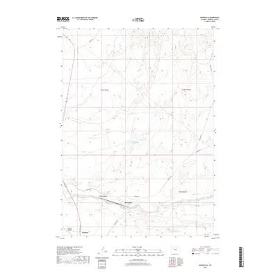
2017 Map of Bonneville
USGS Topo · Published 2017About this map
Bonneville serves as a focal point in this Fremont County landscape, situated near the confluence of Badwater Creek and Bonneville Rd. The area exhibits a sparse, western settlement pattern characteristic of the high desert, with the town of Shoshoni and its Shoshoni Municipal Airport anchoring the southwestern corner. Transportation routes like Birdseye Rd and Quien Sabe Rd cut through the terrain, connecting isolated locations such as Picard Ranch. The drainage of Tough Cr and the presence of the Bonneville Reservoir indicate the vital role of water management in this arid region. Rising above the draws and creek beds, Guffy Peak provides a prominent natural landmark for the surrounding townships of T39N and T38N.
Find a feature on this map
21 named features on this map. Tap any name to fly to it.
Don’t see what you’re looking for? This feature index may not catch every label — zoom into the map to look around manually.
Map Details
Editions of this 2017 Bonneville Map
This is the sole edition of this map. No revisions or reprints were ever made.
Other maps of this area

1950 · Bonneville SW
USGS Topo · 1:24,000

1951 · Boysen
USGS Topo · 1:24,000

1951 · Birdseye Pass
USGS Topo · 1:24,000

1951 · Hidden Valley
USGS Topo · 1:24,000

1951 · Bonneville
USGS Topo · 1:24,000

1951 · Shoshoni
USGS Topo · 1:24,000

1952 · Ocla Draw
USGS Topo · 1:24,000

1952 · Picard Ranch
USGS Topo · 1:24,000

1952 · Guffy Peak
USGS Topo · 1:24,000

1955 · Thermopolis
USGS Topo · 1:250,000