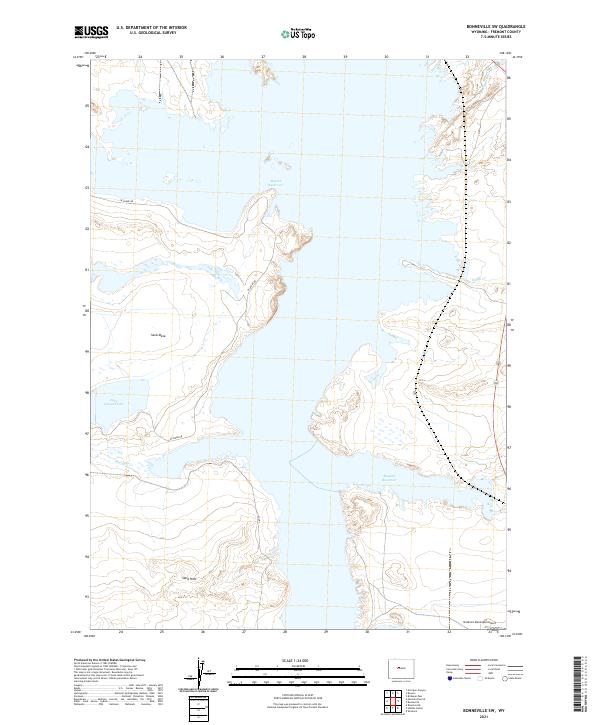
2021 Map of Bonneville SW
USGS Topo · Published 2021About this map
Boysen Reservoir dominates this landscape in central Wyoming, its expansive waters and intricate shoreline defining the character of the region. The map captures the complex interaction between the reservoir and the surrounding high desert terrain, where the Muddy Cr and Tough Cr drainages meet the lake's eastern and western reaches. To the west, the distinct elevation of Sand Mesa overlooks Lake Cameahwait, while the Sand Hills rise to the south, illustrating the shifting geological features that characterize this part of Fremont County. Transport and infrastructure are represented by the transit route along W Shore Dr and the presence of the Shoshoni Municipal Airp at the southern edge, serving as a modern landmark for the nearby community. The map provides a clear record of the reservoir's footprint and the local land divisions within several townships.
Find a feature on this map
17 named features on this map. Tap any name to fly to it.
Don’t see what you’re looking for? This feature index may not catch every label — zoom into the map to look around manually.
Map Details
Editions of this 2021 Bonneville SW Map
This is the sole edition of this map. No revisions or reprints were ever made.
Other maps of this area

1950 · Bonneville SW
USGS Topo · 1:24,000

1951 · Mexican Pass SE
USGS Topo · 1:24,000

1951 · Boysen
USGS Topo · 1:24,000

1951 · Birdseye Pass
USGS Topo · 1:24,000

1951 · Morrison Canyon
USGS Topo · 1:24,000

1951 · Hidden Valley
USGS Topo · 1:24,000

1951 · Bonneville
USGS Topo · 1:24,000

1951 · Shoshoni
USGS Topo · 1:24,000

1952 · Riverton NE
USGS Topo · 1:24,000

1955 · Thermopolis
USGS Topo · 1:250,000