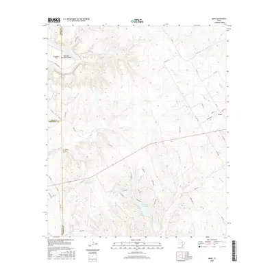
2016 Map of Bono
USGS Topo · Published 2016About this map
The Brazos River winds through the northwestern corner of this Johnson County landscape, where the residential developments of Pecan Plantation and De Cordova Bend meet the river's edge. This 2016 survey illustrates the intersection of rural Texas terrain and expanding suburban communities near the Hood and Johnson County line. Further south, the map is dominated by the topography of Cleburne State Park, featuring the Cleburne State Park Lake and the winding course of W Fork Camp Cr and Camp Cr. The small community of Bono sits to the east, connected to the surrounding countryside by Bono Rd and Fm 2331. Landmarks like Berry Knob and various smaller water bodies such as Young Lake and McCann Lake punctuate the ridges and valleys between the agricultural tracts and growing homesteads.
Find a feature on this map
60 named features on this map. Tap any name to fly to it.
Don’t see what you’re looking for? This feature index may not catch every label — zoom into the map to look around manually.
Map Details
Editions of this 2016 Bono Map
This is the sole edition of this map. No revisions or reprints were ever made.
Other maps of this area

1889 · Granbury
USGS Topo · 1:125,000

1891 · Cleburne
USGS Topo · 1:125,000

1894 · Cleburne
USGS Topo · 1:125,000

1923 · Granbury 1-b
USGS Topo · 1:48,000

1924 · Cleburne 3-B
USGS Topo · 1:48,000

1924 · Granbury 1-c
USGS Topo · 1:48,000

1924 · Granbury 4-a
USGS Topo · 1:48,000

1927 · Blum
USGS Topo · 1:62,500

1928 · Godley
USGS Topo · 1:62,500

1931 · Morgan
USGS Topo · 1:62,500