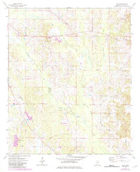
1973 Map of Boon
USGS Topo · Published 1982About this map
Boon sits at the heart of this survey, surrounded by the headwaters of Town Creek and Nanih Waiya Creek. The landscape is defined by its rural network of small churches, including Zion Chapel and New Hope Ch, which served as community anchors in the early 1970s. This edition includes purple photorevision updates from the early 1980s, documenting changes in the terrain such as a Landing Strip and various extractive sites like a Claypit and Sandpit.
Find a feature on this map
21 named features on this map. Tap any name to fly to it.
Don’t see what you’re looking for? This feature index may not catch every label — zoom into the map to look around manually.
Map Details
Editions of this 1973 Boon Map
2 editions found
Other maps of this area

1953 · Meridian
USGS Topo · 1:250,000

1953 · West Point
USGS Topo · 1:250,000

1957 · Meridian
USGS Topo · 1:250,000

1958 · West Point
USGS Topo · 1:250,000

1962 · Vernon
USGS Topo · 1:24,000

1962 · Preston
USGS Topo · 1:24,000

1963 · West Point
USGS Topo · 1:250,000

1965 · Meridian
USGS Topo · 1:250,000

1972 · Louisville North
USGS Topo · 1:24,000
1972 · Noxapater
USGS Topo · 1:24,000