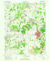
1961 Map of Boonville
USGS Topo · Published 1963About this map
The city of Boonville serves as the focal point of this early 1960s survey, showing a landscape defined by industrial extraction and small-town growth. The Courthouse stands at the center of a dense urban grid, flanked by institutions like St Clements Sch and the High Sch. Surrounding the residential core, the land is heavily marked by the coal industry, with numerous Strip Mines and the Alcoa Squaw Creek Mine Railroad Grade snaking through the northern and western sections of the quadrangle.
Find a feature on this map
48 named features on this map. Tap any name to fly to it.
Don’t see what you’re looking for? This feature index may not catch every label — zoom into the map to look around manually.
Map Details
Editions of this 1961 Boonville Map
3 editions found
Other maps of this area

1900 · De Gonia Springs
USGS Topo · 1:62,500

1901 · Owensboro
USGS Topo · 1:62,500

1902 · Ditney
USGS Topo · 1:125,000

1902 · Degonia Springs
USGS Topo · 1:62,500

1902 · Boonville
USGS Topo · 1:62,500

1905 · Newburg
USGS Topo · 1:62,500

1951 · Yankeetown
USGS Topo · 1:24,000

1952 · Newburgh
USGS Topo · 1:24,000

1954 · Evansville
USGS Topo · 1:250,000
1954 · Richland
USGS Topo · 1:24,000