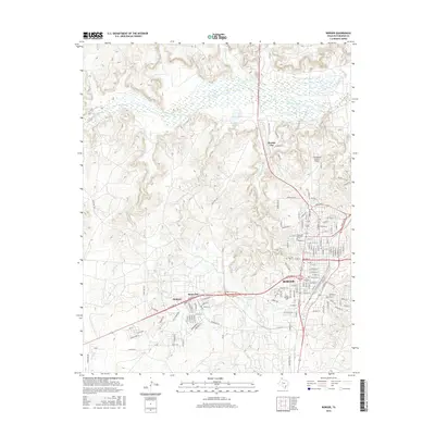
2016 Map of Borger
USGS Topo · Published 2016About this map
The industrial and residential landscape of Borger dominates this Hutchinson County survey, showing the city's complex street grid and its surrounding neighborhoods. Settlements such as Bunavista, Philrich, and Electric City are clearly delineated, illustrating the region's dense post-war development pattern tied to the local energy sector. To the north, the Canadian River cuts through the terrain, joined by several seasonal drainages including Tar Box Cr, Cottonwood Cr, and Antelope Cr. Institutional landmarks such as the Frank Phillips Coll and the Highland Park Cem are prominent within the urban core, while the Hutchinson County Airport serves the higher ground to the northeast. The southern reaches of the map show an transition into industrial corridors, with labels like Carbon Rd and Industrial Blvd reflecting the area's economic foundation, while Weatherly Lake provides a localized water feature near the city's western edge.
Find a feature on this map
134 named features on this map. Tap any name to fly to it.
Don’t see what you’re looking for? This feature index may not catch every label — zoom into the map to look around manually.
Map Details
Editions of this 2016 Borger Map
This is the sole edition of this map. No revisions or reprints were ever made.
Other maps of this area

1939 · Sanford
USGS Topo · 1:62,500

1953 · Sanford
USGS Topo · 1:24,000

1953 · Plemons
USGS Topo · 1:24,000

1953 · Stinnett
USGS Topo · 1:24,000

1953 · Deal
USGS Topo · 1:24,000

1953 · Borger SE
USGS Topo · 1:24,000

1953 · McBride
USGS Topo · 1:24,000

1953 · Phillips
USGS Topo · 1:24,000

1953 · Borger
USGS Topo · 1:24,000

1954 · Amarillo
USGS Topo · 1:250,000