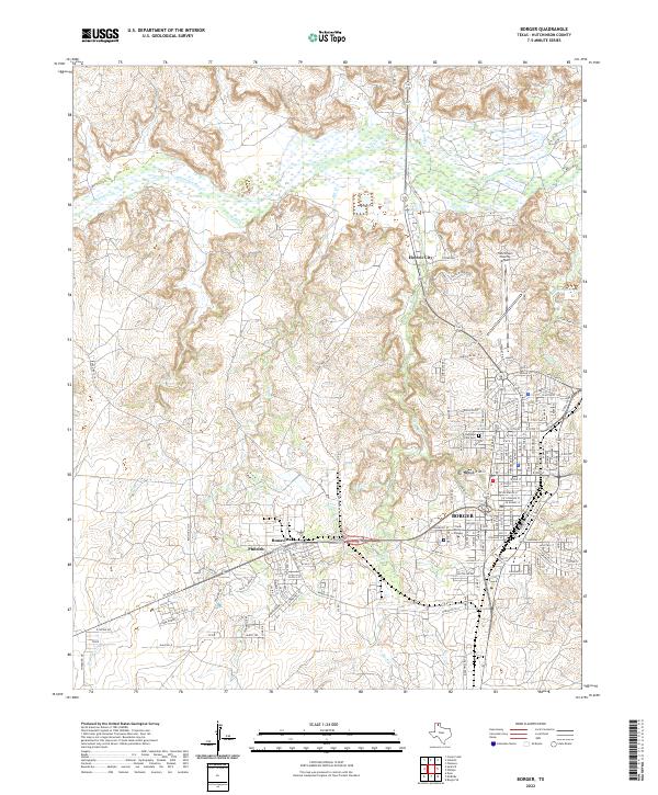
2022 Map of Borger
USGS Topo · Published 2022About this map
Borger serves as the industrial and educational anchor of the Texas Panhandle in this contemporary survey, characterized by its dense street grid and proximity to the Canadian River. The landscape reflects a legacy of energy and petrochemical development, seen in the industrial corridors along Industrial Blvd and the clustering of residential areas like Bunavista and Philrich. To the north, the terrain drops into the rugged breaks of the river valley, where seasonal waterways like Antelope Cr and Tar Box Cr carve through the plains. The presence of Frank Phillips College and the Hutchinson County Airport highlights the city's role as a regional hub. Local heritage is preserved at Highland Park Cemetery, while the surrounding geography is defined by managed water resources such as Weatherly Lake and the Pantex Reservoir, illustrating the careful balance of industry and environment in this arid landscape.
Find a feature on this map
77 named features on this map. Tap any name to fly to it.
Don’t see what you’re looking for? This feature index may not catch every label — zoom into the map to look around manually.
Map Details
Editions of this 2022 Borger Map
This is the sole edition of this map. No revisions or reprints were ever made.
Other maps of this area

1939 · Sanford
USGS Topo · 1:62,500

1953 · Sanford
USGS Topo · 1:24,000

1953 · Plemons
USGS Topo · 1:24,000

1953 · Stinnett
USGS Topo · 1:24,000

1953 · Deal
USGS Topo · 1:24,000

1953 · Borger SE
USGS Topo · 1:24,000

1953 · McBride
USGS Topo · 1:24,000

1953 · Phillips
USGS Topo · 1:24,000

1953 · Borger
USGS Topo · 1:24,000

1954 · Amarillo
USGS Topo · 1:250,000