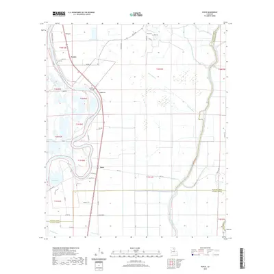
2020 Map of Bosco
USGS Topo · Published 2020About this map
The Ouachita River meanders through this landscape on the border of Ouachita and Caldwell parishes, defining a region where Bayou systems and wetlands dominate the geography. Small settlements like Fondale, Logtown, and Bosco are situated along the primary north-south corridor, linked by roads such as Mansfield Rd and River Rd. The map reveals a complex network of water bodies, including Halfway Bayou, Bayou La Fourche, and Lake Lafitta, which suggest a floodplain environment historically shaped by water movement.
Find a feature on this map
54 named features on this map. Tap any name to fly to it.
Don’t see what you’re looking for? This feature index may not catch every label — zoom into the map to look around manually.
Map Details
Editions of this 2020 Bosco Map
This is the sole edition of this map. No revisions or reprints were ever made.
Other maps of this area

1935 · Alto
USGS Topo · 1:62,500

1939 · Fort Necessity
USGS Topo · 1:62,500

1940 · Monroe
USGS Topo · 1:62,500

1940 · Columbia
USGS Topo · 1:62,500

1955 · Jackson
USGS Topo · 1:250,000

1955 · Shreveport
USGS Topo · 1:250,000

1956 · Shreveport
USGS Topo · 1:250,000

1957 · Columbia
USGS Topo · 1:62,500

1957 · Mangham
USGS Topo · 1:62,500

1957 · West Monroe South
USGS Topo · 1:24,000