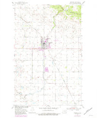
1955 Map of Bottineau
USGS Topo · Published 1981About this map
Bottineau serves as the focal point of this mid-century survey, revealing a well-established prairie community at the foot of the Turtle Mountains. The landscape is a study in transition between the elevated terrain of the north and the expansive agricultural plains of Pickering and Oak Valley. Institutional history is prominently featured with the North Dakota School of Forestry on the town's northern edge and rural education centers like Vinje Sch and School No 1 scattered across the township grid. Transportation and recreation patterns are clearly defined by the Burlington Northern railroad lines and the Bottineau Country Club tucked along the banks of Oak Creek. Local burial grounds, including Mount St Mark Cem and Oak Creek Cem, provide valuable landmarks for genealogical research, while the Bottineau Municipal Airport marks the era's modern infrastructure.
Find a feature on this map
21 named features on this map. Tap any name to fly to it.
Don’t see what you’re looking for? This feature index may not catch every label — zoom into the map to look around manually.
Map Details
Editions of this 1955 Bottineau Map
3 editions found
Other maps of this area

1954 · Omemee
USGS Topo · 1:24,000

1954 · Souris SE
USGS Topo · 1:24,000

1954 · Gardena
USGS Topo · 1:24,000

1954 · Minot
USGS Topo · 1:250,000
1955 · Upham NE
USGS Topo · 1:24,000

1955 · Bottineau
USGS Topo · 1:24,000

1955 · Bottineau SE
USGS Topo · 1:24,000

1956 · Metigoshe Lake
USGS Topo · 1:24,000

1956 · Carbury
USGS Topo · 1:24,000

1956 · Lake McArthur
USGS Topo · 1:24,000