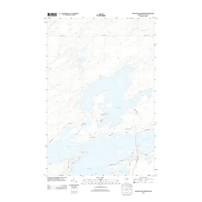
2013 Map of Boulder Lake Reservoir
USGS Topo · Published 2013About this map
Boulder Lake Reservoir and Island Lake Reservoir dominate the landscape in this portion of Saint Louis County, showing the extensive water management infrastructure north of Duluth. The intricate shoreline of the reservoirs is defined by numerous points and islands, such as Bear Island and Tomahawk Point, reflecting the transformation of the natural hydrology where the Us-Kab-Wan-Ka River and Cloquet River meet. The area is interlaced with a network of local roads including Boulder Dam Rd and Rice Lake Rd, which provide access to seasonal homes and recreational sites along the water's edge. Smaller, natural water bodies like Twin Lakes and Nevens Lake remain in the northern reaches, offering a contrast to the larger man-made reservoirs. The map captures the balance between natural river systems and the engineering required to maintain these large water storage basins in the early 21st century.
Find a feature on this map
30 named features on this map. Tap any name to fly to it.
Don’t see what you’re looking for? This feature index may not catch every label — zoom into the map to look around manually.
Map Details
Editions of this 2013 Boulder Lake Reservoir Map
This is the sole edition of this map. No revisions or reprints were ever made.
Other maps of this area

1895 · Duluth
USGS Topo · 1:62,500

1953 · Twig
USGS Topo · 1:24,000

1953 · Shaw
USGS Topo · 1:24,000

1953 · Arnold
USGS Topo · 1:24,000

1953 · Boulder Lake Reservoir
USGS Topo · 1:24,000

1953 · Fredenberg
USGS Topo · 1:24,000

1953 · Duluth
USGS Topo · 1:62,500

1953 · Duluth
USGS Topo · 1:250,000

1954 · Thompson Lake
USGS Topo · 1:24,000

1954 · Hibbing
USGS Topo · 1:250,000