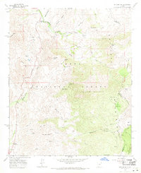
1964 Map of Boulder Mtn
USGS Topo · Published 1971About this map
Sunflower and the Diamond Ranch serve as primary points of interest in this high-altitude landscape of central Arizona, surveyed just after the mid-century. This portion of the Tonto National Forest is defined by a dense network of mountain trails, including the Mazatzal Divide which segments the terrain into deep canyons and prominent peaks. The map reveals the intricate water resources essential for livestock and travel, from the Bushnell Sheep Tank to numerous springs like Crabtree Spring and Weiss Spring.
Find a feature on this map
47 named features on this map. Tap any name to fly to it.
Don’t see what you’re looking for? This feature index may not catch every label — zoom into the map to look around manually.
Map Details
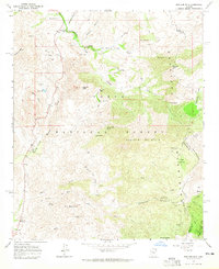
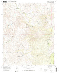
Editions of this 1964 Boulder Mtn Map
3 editions found
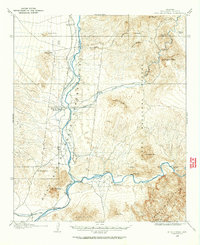
Other maps of this area
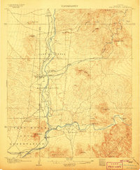
1904 · Ft. McDowell
USGS Topo · 1:62,500
1906 · Ft. McDowell
USGS Topo · 1:62,500

1907 · Roosevelt
USGS Topo · 1:125,000

1909 · Four Peaks
USGS Topo · 1:125,000

1912 · Roosevelt
USGS Topo · 1:125,000

1930 · Cave Creek
USGS Topo · 1:125,000

1939 · Cave Creek
USGS Topo · 1:125,000

1954 · Mesa
USGS Topo · 1:250,000

1957 · Mesa
USGS Topo · 1:250,000

1958 · Mesa
USGS Topo · 1:250,000