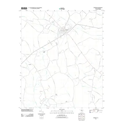
2011 Map of Bowman
USGS Topo · Published 2011About this map
Bowman serves as the central hub of this Orangeburg County landscape, where the Bowman Post Office and a network of residential streets like Tupelo St and Gum St define the small-town core. The surrounding countryside is marked by significant hydrological features, including the meandering path of Cow Castle Creek to the northeast and the broad drainage of Polk Swamp to the south.
Find a feature on this map
90 named features on this map. Tap any name to fly to it.
Don’t see what you’re looking for? This feature index may not catch every label — zoom into the map to look around manually.
Map Details
Editions of this 2011 Bowman Map
This is the sole edition of this map. No revisions or reprints were ever made.
Other maps of this area

1919 · Lodge
USGS Topo · 1:62,500

1920 · Bowman
USGS Topo · 1:48,000

1920 · Lodge
USGS Topo · 1:48,000

1920 · Orangeburg
USGS Topo · 1:48,000

1920 · St. George
USGS Topo · 1:48,000

1921 · Orangeburg
USGS Topo · 1:62,500

1921 · Lodge
USGS Topo · 1:62,500

1921 · Bowman
USGS Topo · 1:62,500

1921 · St. George
USGS Topo · 1:62,500

1943 · Bowman
USGS Topo · 1:62,500